Showing posts with label Trains. Show all posts

Friday, August 7, 2015

More From Limestone Canyon


I’ve written about Limestone Canyon and Forest Service road 573 before, and how it’s my “default” riding area on those days when I don’t get out of bed early enough to go elsewhere…but there are days when I choose it regardless.

The road starts just north of Paulden, AZ, heading west from highway 89, just a bit south of the soon-to-be-replaced Hells Canyon Bridge. It was one of the 1st off-roading trips I took in the area after moving here to Chino Valley, and the feeling I got from it was one of isolation and remoteness. Interesting, since the lower area was home to a small community in the early 20th century. According to late 1800’s maps, there was also an “old fort” in the area as well…but again, the few efforts I know of to find it (including my own ) have turned up little. And as I mentioned in my linked post, most of the 1st several miles were home to the original alignment of the Santa Fe, Prescott, and Phoenix Railroad and its tumultuous route off of Big Black Mesa. A lot of “stuff” for such a lonely feeling place. Only the old ROW for the train, a decaying charcoal kiln, and probably some graves remain.

Once 573 reaches the top of Limestone canyon, it follows the top of Big Black Mesa for several miles, offering a great view with slightly cooler temps, and a nice remote experience without being too far from the world. The old rail line leaves sooner, but remains just a short ride to the east on a few of the side roads. Our primary goal was to be in the back-country, but the secondary goal was to hike a railroad cut on the northern end. Turns out it would take a couple of tries.

The first attempt was under the neighborhood of a 70% chance of monsoon rains and a flash flood alert, but the weather people out here are worse than average, so it was no surprise when we needed sunblock at the staging area.
Weather wasn't too bad when we started.
After winding our way past miles of juniper and rock peeking out from above, we took a side trip to one of the many earth water catchments called Upper Limestone tank. Standing guard is an old corral that may not be up to the task these days...along with a few other relics.

The old corral 
I’m always fascinated by such artifacts, and often wonder just how long they have been around. I can’t help but wonder if the hands involved are still with us…and if they enjoyed what they were doing as much as I think I might have, had my “job” involved such a workplace. Cattle stomp around in the very low water, the level of which surprises me. This tank has always been full enough to qualify as a small pond, and we have had decent rain in the past several months since I’ve been here. And we are about to get more.

By the time we move on the clouds have moved in, and we are definitely a go for rain in the next few hours, but we were prepared. Sorta.

By the time we turn east on FS601 and stop near the cut, the lightning is flashing in the distance, and the tell-tell ghostly stains of rain are streaming from cloud to earth. As I mentioned above, 573 this far north is at the top of a long mesa, with little ground higher than the road itself, so it’s not the place to be during a lightning storm. Thankfully, our parking spot is a low lying area with trees for protection ( and alternate targeting for any bolts from heaven ).  Just as I grab my gear to step out for the hike, the clouds let go into a slow, steady rain. So we parked under a group of thick Junipers, put on our $1 “emergency ponchos” ( about like a cheap garbage bag with a hood), and opened up the liquid refreshment to wait it out. And waited. And waited.

You can't tell from the pic, but as we stopped for a hike, the rain started to come down.
Stuff like this normally doesn’t last in the desert…but this, as it turned out, was the remains of a tropical storm from the Gulf of Mexico, and it wasn’t letting up anytime soon. Being in a SxS meant that we were mostly shielded from the rain, as was our gear, but some still sneaks in from the sides and front, and we were slowly getting soaked below our protective gear. Heading back meant that we would REALLY get it from the front with no windshield, but to delay any longer would have just brought us closer to getting really cold, so we made for the trailer. What followed was 45 minutes of the most fun trail riding I’ve had for some time…

Rain in the desert is a special event. Even though it’s not very rare, being out in the back-country to see it is. As we climbed back up to 573, the rain was pouring, and while the lightning was flashing in the distance, it was far enough away to be of little concern. In the slow climb over this rocky side road, I slowly watched the desert transform from dusty red soil to sloppy flying mud, with the earth all the while exhaling with relief. Dry washes and gullies I had ridden by hundreds of times were now flowing with runoff, and I couldn’t help but stop and examine a few. What the hell? I was already wet…


I’m sure many of the huge jack-rabbits in the area were hunkered down under Juniper or Manzanita wondering what these 2 fools were doing splashing through the rain, and the mist from the rain itself hitting us in the face and running off the Pioneer's top ( right in our laps…thank you Mr. top engineer! ) was exhilarating to say the least. Too much so, as the storm has dropped the temperature enough to be a bit chilly. A little cold, but quite an entertaining ride for those next few miles to the waiting trailer, cutting the ride short at around 4 o’clock. I normally don’t pack it in until well after dark, and had we the proper rain gear, we might have stayed out there until wife-pissed thirty.
About the only regret was that the rain put the kibosh on much in the way of photos…and I can’t believe I didn’t think of the GoPro's water-proof case, but mounting it to get anything other than a wet lens would have been difficult. Still, a memorable moment provided by Mother Nature for reasons many people would never understand.

What is it about such a simple event that makes it so memorable? Why does something my wife considers me crazy to enjoy cause two grown men to giggle like kids and have a blast? Why is it that despite being soaking wet and cold, we both absolutely hated to leave?
My theory is because the added elements outside the comfort zone change it from being a fairly normal event into an adventure…in a Walter Mitty sorta way. I love to get out and trail ride, and do so almost every weekend, but adding some lightning and a downpour transformed it into something truly memorable even though we were in no real danger. Yet the personal legend grows with each one of these, and another story to tell the kids hits the books.

My advice for you is the next time you are thinking about trail riding, and you look out the window and see those clouds…and wonder if you should? Go for it anyway. Worst you can do is get wet and cold. The best you can do is to have a blast.

Coming soon: Attempt number two!

DISCLAIMER: It is possible my wife is right, I am crazy, and you shouldn’t ride in adverse weather conditions.


Thursday, January 8, 2015

Trail Archaeology

I love seeing where trails go, and that includes old ones. The state of Arizona is littered with trails, and some of them are slowly returning to the earth. Unused, for whatever reason. Many times they went nowhere important and died for good reason. Every once in a while though, you discover a hidden gem or great spot to take in the desert.

Verde River near Bear siding.
A few weeks ago, my brother-in-law and I were set to head to warmer climates in Wickenburg, AZ, for our weekly ride. This is about a one-and-a-half hour drive, so i had gotten up pretty early to prepare...when word came that he was sick with the flu, so I would be solo today. I wanted to save Wickenburg for both of us, so I decided to just go out to an area called Perkinsville not too far from my home.
I have ridden here extensively, and know most of the trails pretty well...or so I thought. I like this area, as it has some old features linking the past to the present. Among them is the Arizona Central's freight line to the Drake interchange with BNSF, originally built in 1912. Little used, but used enough to still warrant existence. The Verde River also flows through this area, and the hills abound with old flagstone mines, both active and abandoned. Certain sections have that awesome southern-Utah-red-rocks appearance that I love. This area feels older than the rest in some way, and while I have spent hours exploring most every nook and cranny...I get the distinct impression it's hiding something from me out in one of those canyons.

After unloading just south of the Verde River Bridge on what is technically Forest Service 9899D - just a little triangle between FS318 and FS354, I headed on out. The temps were cold that morning, and after a few hundred yards is was contemplating turning and heading back for the trailer, but decided to stop and try my $5 windshield (which looks a lot like a blue tarp and  bungee cord) to see what effect it would have. You would think nearly ¼ century on street bikes would have taught me a lesson of the importance of getting out of the wind to stay warm…but it is one  re-learned after strapping down the bungee. Huge, HUGE difference with no constant wind-blast! One of those ¼ windshields is now a priority for the Pioneer.

Ice forming in the Verde. It was chilly!
Now with the ability to focus on the ride instead of my freezing face, I now rolled on across the Verde River Bridge and noticed the sheeting of ice on some of the slower sections and canals. Alternations of heavy frost and damp patches kept location with the suns warming rays as I rounded a few corners to the Arizona Central track crossing just to the north. There is a stop sign here, but I wanted to pull over and listen anyway. My B-I-L and I were here last weekend, and I thought I had heard the AC train somewhere. This train allegedly runs very early, so I was a bit surprised by the sound. Again today, I heard the rumbling in the distance, but it never seemed to change in tone, so after some time I moved on to the north.

Old trail to horseshoe curve.
A few miles up the road is a secret little trail that I know of that leads down to the tracks in a horseshoe curve area. FS9115W is the official name of the start, but a few forks and this ends at the south end of a long plateau overlooking the Verde River canyon. The heavy traffic ends here, as do the “tourist” riders. The actual trail, perhaps overlooked by many, continues on down a fairly steep and rocky hillside, and is clearly marked on topo maps. It is very obviously and old service road for the tracks, and looks to have been washed out of its original configuration, re-pushed, and then let go. It seems to see occasional use by something, and some wooden strips were installed on the ties to facilitate crossing the tracks…but I suspect this is an emergency-only trail for the railroad, if then.

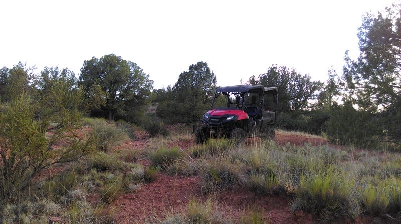
Pioneer and $5 windshield. My secret trail climbs that ridge behind.
I wonder if anyone currently working on the AC even knows it’s there…or did that knowledge die off with older generations? At any rate, the difficulty and location mean it’s a good place for me to be alone with the desert. Topo maps actually show that this trail once went all the way down to the Verde River, but light scouting on foot showed little sing of this now. At any rate, the local government bowed to the screaming eco-terrorists some time ago, and any real “road” to the Verde in this area was gated or fenced off, so it probably matters little.

Faint trail heading through the bushes...
After some time I made my way back to the main road and headed over to FS492 (AKA-Drake road), and then turned south on FS492A. This road sees some pretty decent traffic due to the fact that it has some of the easier access to the Verde and is a popular camping spot. It also passes some interesting artifacts and place names. It travels down between some rocky ridges, and to me it should have some Indian ruins somewhere ( it has that look), but I have not discovered them thus far. 
After rounding one of the ridges you will find the view opens to the south to train tracks, and you come across what apparently used to be a siding and a platform for loading train cars, along with one of the few official crossings of the AC. This is Bear siding, adjacent to Bear canyon.  The tracks for the siding are still there, but obviously haven’t been used in some time, save for maybe setting out a bad car now and again. There is also some sort of well or holding tank with a concrete cover, but devoid of anything but trash these days. Just to the track-north is one of the trestles on the AC which has some large concrete fixtures for something long-gone. I have done casual research on the area but turned up nothing. As I said, the place is hiding secrets.

Bear siding

Loading...um, thing.
Trestle over Bear canyon.
Well? Holding tank? I'd like to know...
The reason for the siding is no secret; a mile or two on down the road there are a few mining pits, but I don’t know what they mined. It was obviously enough to warrant loading into train cars at bear siding.  Perhaps some of the other mines in the area shared this location as well. While here, I confirmed that the cold desert air causes train noises to travel all the way from the BNSF main line several miles to the west of Pekinsville, and those were the trains I was hearing…sadly, not the AC. 

Verde River
There are 2 roads here that are old, little used, and head south. After riding down to the Verde to take some photos, I returned to see where they went. The 1st one parallels the tracks for a few hundred yards, and then turns east on my map, but peeters out on the ground. Back up at the main trail at the siding, another road just east also heads off in this direction, but is not shown on my maps. After following it down, it became obvious that this was the end of the 1st trail, and over the years it just became easier to start further east than cross the small ridge and gullies from the “old” trail. 

Bear siding and trails
This was, again, and old railroad access/maintenance road that lead down to the tracks. It ended at the tracks…or did it? My map had the trail continuing across and down to a “Boggy tank”. Investigations unveiled that someone had piled a bit of brush to hide the fading old trail…but it did go on, and In the process of following it, I came across a sizable water catchment using the railroad fill as an earth damn. It was dry today, but looked to have held pretty deep water at its peak. A nice discovery.


Back up at the “end” at the tracks, you could see where the old trail had come across the ridge and down to its newer counterpart, so I decided to backtrack until it ran out, which didn’t take long. Interestingly enough, I did find a sizable can-dump, which suggests there was a camp here for some reason. Was it for the original construction of the railroad? I don’t have the knowledge to make that guess, but it certainly could be. If that’s the case, it seems like it has been mostly undisturbed for 102 years!

Backing out to Drake road, I intended to head over toward the Indian ruins to scout for down firewood since the season was drawing to a close, but just yards from where 492A hits Drake road, another FS road heads north, labeled as FS9119A, or Mexican Quarry road. On the surface, this trail parallels another main road that I have ridden many times, so I had dismissed it as going nowhere (trail prejudice). In reality, it heads up a decent sized canyon to some flagstone quarries and a few nice camping spots, ending at Mexican tank. Another surprise from the area, but one more was in store…

Back out Drake road to FS354 and south towards Perkisnville, my intent was to take FS181, which heads to some well-known Indian ruins several miles away on the edge of Sycamore canyon. Along the main road there are several side trails, and I thought I had ridden them all…but one went by that I couldn’t remember, so a U-turn and several miles of FS9004T later, I was sitting above Little Sand Tank, nearly to Sand Flats road and Government Canyon far to the north, and not too far from Henderson flat (normally accessed by FS181). I had no ideal there was a road in this area, but yet gain this place surprises me.

Verde River
I 1st swung a leg over a quad in 1990 or so, learning to ride in the Blue Ridge Mountains of NC on old logging roads where there was an abundance of good, and not so good trails. Some of them were faint and returning to the past, and I’ve always had a fascination as to why they were there, where they went, and a want to return them to use. Nearly 25 years later, not much has changed. A ride that seemed to be mostly about known trails ends up offering up some new ones…both well-used and almost forgotten. Again, this area delivers a solid day of adventure.


Sunday, December 2, 2012

Back-country exploration: Limestone canyon.


You can be forgiven if you don't know where Limestone canyon is....I didn't, and I live only minutes away. The canyon itself has historical significance in part by being the original location of the Santa Fe, Prescott & Phoenix railroad route ( today's BNSF ). But it's value extends beyond history or the interest of a rail buff...it is also home to many miles of trails both in the canyon itself and the surrounding area. I have now been on several rides in the area...along with a few Jeep trips. None of these trails are particularly hard, nor did I really expect much from this area, but as usual, I got a few surprises....and I have just scratched the surface of this trail-riddled area. Unfortunately, many of the trails are not on most maps...and many are not marked. The best thing to do is just go out and start following trails....

The main street for the area is FS573 just north of Paulden, and just south of the Drake cement plant that serves as a distant sentinel for most of the riding here. There are a number of places to stage just off the main road, and trails start going in all directions. FS573 itself travels north several miles and eventually becomes Bullock road that connects back to hwy 89 just south of Ash Fork. The railroad history will soon make itself present with arrow-straight tangents, cuts and fills.
One item of interest you will encounter of FS573 is a crumbling old kiln that dates from the late 1800's.

The old kiln on FS573.
The kiln is in pretty bad shape, and is fenced off to keep stupid people from hurting themselves.
After passing the kiln you will climb a bit, passing the remains of an old trestle on the left, and rejoin the old railroad ROW ( right-of-way ), as evidenced by the shelf road you will now be traveling on.. After a bit you will encounter a large fill with a sign marking Lower Limestone tank and FS9017R.

FS9017R heads in a north-easterly direction and into some open grasslands with many trails heading off. In general, stay to the left and you will be on the main trail. This trail is pretty cool and winds its way back and forth across a small canyon, and is just a cool little 2-track. On the day of this pic, monsoon season rains born rise to a sea of wildflowers in one of the open areas.

Thanks to monsoon rains, a little extra color was present on this day.
Like a number of north-heading trails on the lower part of FS573, 9017 dumps you out on FS640. 640 can also be accessed via hwy 89 just north of the turn for 573.

FS640 is perhaps my favorite trail in the area. Maps show it ending after a few miles, but in reality it travels for several miles adjacent to hwy 89, following the same general route as 573, but some miles to the east. 640 finally splits, then ends in the area of the upper hell's canyon crossing of hwy 89 ( where the train trestle is visible on the left heading north ). On the way, it winds over ridges, past old tanks and corrals, and is just fun to ride. There are some scenic bluffs on side trails to the west, but none actually go anywhere.

Beautiful peaks on FS640.
FS640 will eventually force you to go right at a "T" . This will take you across Hell's Canyon and over to the current ROW for the BNSF railway where it ends.

Fall has come to Hells Canyon!
End of the line for FS640 to the east.
Turning left ( west ) at the "T" will take you back up into a small side wash where the trail fades, but not before I noticed an unexpected find: Petroglyph rock art! They look genuine. Very cool.

An unexpected find: 2 rocks covered with petroglyphs. Awesome!
If you decide to go check these out, remember that they are protected by Federal law!
Back down 640, several trails head east, and most of these have to go over to HC. I picked one unmarked trail that just happened to be a pretty neat little trail into, and across HC....just ( canyon ) north of the first hwy 89 crossing at Drake cement. Despite it's name, hell's canyon has some beautiful scenery....

Another trail crossing Hell's canyon. I'm heading west here...but a large bit of leftover water complete with plenty of prints was just out-of-frame to the left.
After heading across the canyon this trail heads in the general direction of hwy 89 and meets up with numerous other trails, but I did not explore these save for 1 that led up to the east rim of HC with a nice view of the hwy 89 crossing.

Highway 89 bridge to the left.
Now back to FS573...
North of  9017R, FS172 heads east for a few miles. There are numerous side trails, and this trail crosses the old railroad ROW with some pretty extensive rock-work. This trail simply ends at a tank overlooking a slot canyon. Worth riding just to explore....and who knows where all those other trails go.....

Further north on FS573 you will encounter FS601 heading east. This goes over the ridge and down to a sizable old railroad cut and fill. Once at the bottom of the hill, this trail runs into others, but these are all very lightly used, and hard to follow...although there are markers for them. More exploration is needed here. Nice views from the top.

I haven't mentioned trails heading west from FS573 yet. There are a few....and most don't seem to go anywhere. After passing 173 heading north on 573, an unmarked trail will head left at the top of the ridge. This leads to a sizable tank and what seems to be a wet-weather lake. The main trail continues to the west past these, but the trail simply seems to fade. Considering other finds just north of here, I would like to re-visit this trail to see where it may go...

North of FS601 you will encounter FS174 heading west. This was one of the surprises of the area. 174 turns down into an open field with a raised roadway. 174 will soon head west while what seems to be the main trail ( FS174A ) continues north. 174A twists and turns for some miles through the trees with numerous trails going in every direction. I have yet to ride many of these.
The real treat here is 174 that turned off earlier. This heads west, curves around a cattle pin and tank, and heads out on a high ridge overlooking canyons and a large, flat plain.

Quite a view from 174.
174 alone is worth the trip up here. 

174 ends near the top of a canyon , but there is a hiking/biking/dirt bike trail that seems to lead into the valley. I'm not sure what area this is, but the view here must be seen, and judging from the amount of use this trail has seen, many agree.

FS573 soon turns into Bullock road north of here. There are a few other trails here that need to be explored...but I don't have much hope of them going anywhere....but you never know. They are on my to-do list anyway. Hopefully I'll get back soon...