Monday, November 24, 2014

The Search for Bradshaw's Grave, Part II


In my last blog post I recounted an attempt to find the grave of Isaac Bradshaw and the numerous abandoned mining sites close by. These sites are easily accessed from the south via Wickenburg, AZ, by a popular trail printed in major off-road books. My goal was to access this area from the north and Wagoner road ( FS362 ) in an area known as Johnson’s flat. My 1st attempt resulted in a missed turn that couldn’t have been more obvious if it featured a neon sign pointing south saying “Bradshaw’s Grave”. There was a group of dirt-bikes taking a break at the location, so maybe the view was just blocked. 

I also did some reinforcement in the way of GPS help. My Magellan Explorist 400 has never had the detail on its’ “detail map” to truly use as a trail guide, so I have been experimenting with using an old smartphone and TOPO maps app for an inexpensive GPS ( and GoPro remote ). In this case, Trimble outdoors app and a 14 day free trial kept me aware of what trails I was taking…though this app has proven to have mixed results despite working without a hitch this day.


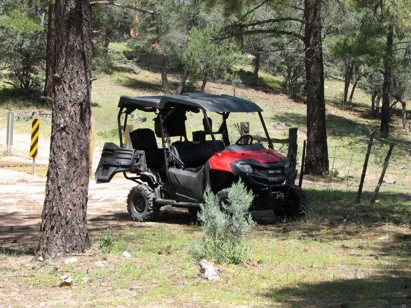
Anyway, a week after out last attempt, my brother-in-law and I returned to try our hand again. This time taking the right road, albeit one unnamed on any map I can find. All I can tell you is that it turns due south just east of oak-creek windmill, and eventually passes Tussock springs. It is a well-traveled route, and we met several Jeeps, SxS’s, and quads on the day.


Shortly after turning south, the road then splits with east-west choices, us taking the west route. This wound its way around the tops of several tall ridges, ending at what was some sort of mining claim on Lehman Mountain.


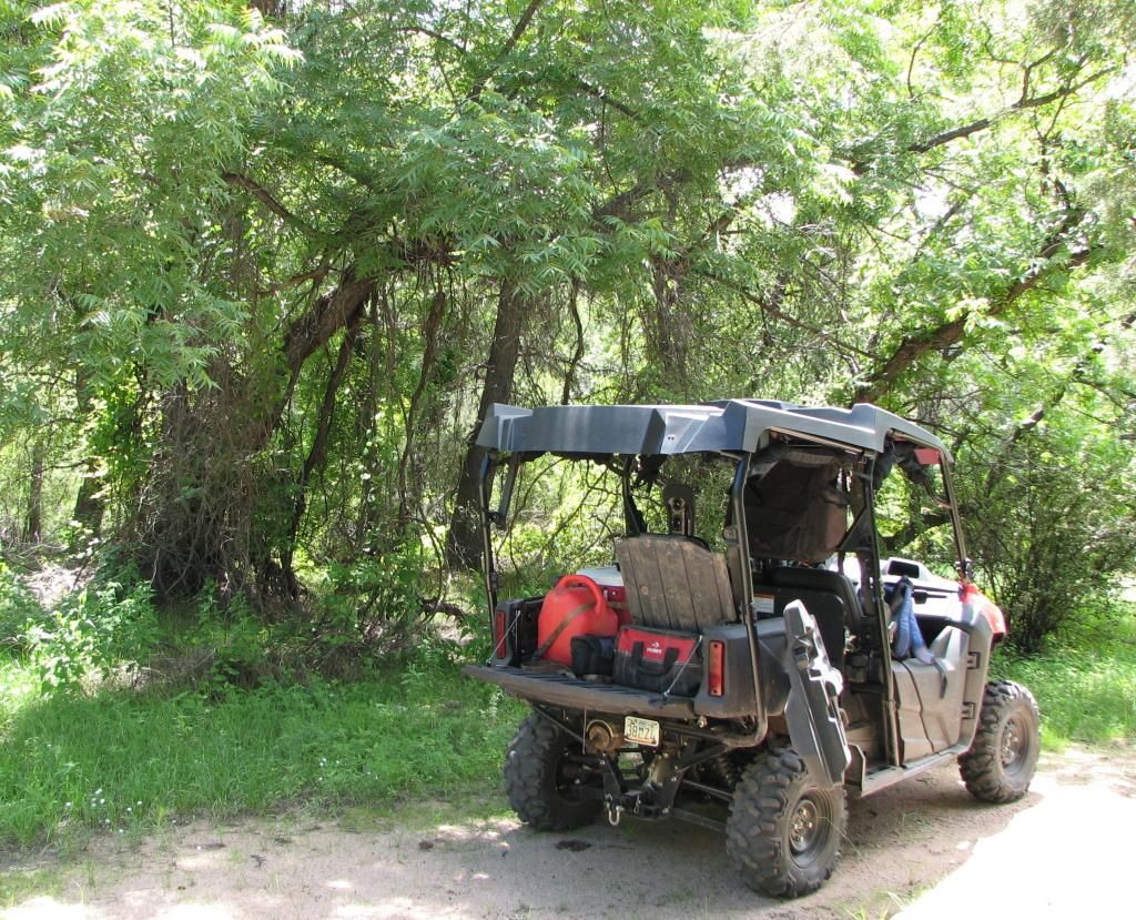
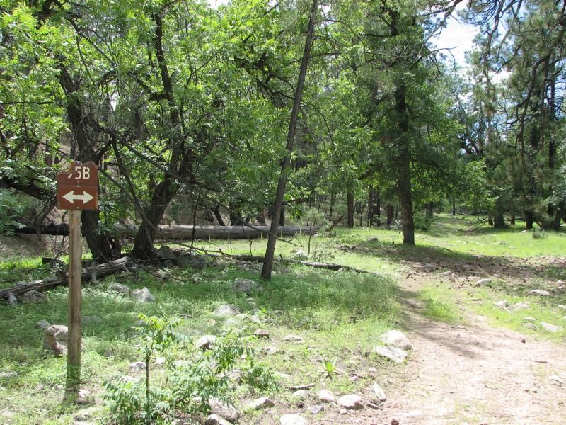
Along the way we passed a trail that led down into one of the canyons and a mark on the map called Lehman Mill. It sounded interesting, so we decided to investigate. 
The trail itself wound down into a wash which it followed for several hundred yards. Despite the Record Monsoons rains we had this year it was largely intact with only a few skid plate grinds to show. Eventually we arrived at a windmill and a small corral, with roads leading in three directions.

Initially I was disappointed, as I thought this was the Lehman Mill we had seen…and there was nothing but your garden-variety Arizona windmill and some tanks. A quick look on my “new” GPS confirmed that the mill was a bit further to the south, so we proceeded in that direction, noting that an older trail also headed off up the hillside to the south. After a few hundred yards, we came upon what was obviously Lehman’s mill, complete with boiler and various ruins.


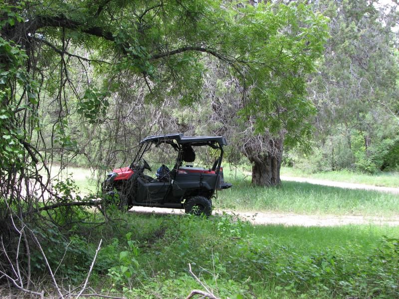
After taking a break to investigate the area and consult the TOPO app, we headed back to the older road to the south, thinking this was the road we were looking for that headed to Bradshaw’s grave. 
Actually, this road does go to that area…but it has been in a state of disuse for many years, and research found a ride report from 2009 where a group of quads did this trail and found it to be just big enough for quads…as I found out after a few hundred yards of travel. Too tight for my SxS, so we turned back, thinking that our intended route to the grave was yet again foiled.

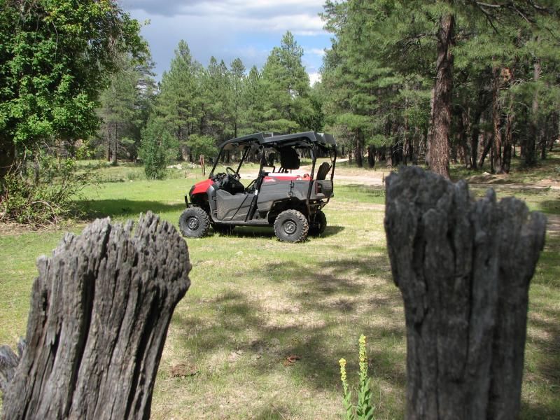
Now, back at the windmill there was a trail that traveled up the mountain to the west and looked to be fairly used, but I dismissed it as not going anywhere…something I tend to do at times based on what I think I know. I call it trail prejudice.
 Keep this in mind as you continue to read this ride report…

At this point we headed back up and out, all the way back to the original split just south of FS362. Looking at maps, it appeared an alternate route might be found in this area to the south-east of our intended destination, but it would take some miles of riding to do. So we set off down the trail for several miles until we hit a split, with signage of the west branch informing us that Walker Gulch was in that direction. It also seemed to go back in the general direction of Bradshaw’s grave, so we took this for a few miles until we decided to take a photo break.


By this point we were in honest-to-goodness Sonoran desert, complete with towering Saguaro cacti all around. Despite riding in Arizona for a few years now, this is only the second time I have encountered these majestic sentinels of the American West…strange when you consider how much I love the low desert; even the smell is comforting to me.


By this time it was getting a little late and we had seen nothing promising in our pursuit, and I was coming to accept that fact that we were NOT going to make Bradshaw’s grave yet again. 
At that point I pulled out the TOPO app again and looked for any quick ways…when one caught my eye and gave us new hope for possibly making it to our destination. Back tracking only a few hundred yards sent us on a side trail ( an actual trail ) of twisting two-track that wound its way across ridges and trough dry washes…and really put the capabilities of my Pioneer to the test. Fact is, the monsoon’s had taken their toll on this trail, and several sections looked more like single-track than the quad trail it started life as. This all came to a head on a narrow spine heading uphill with a giant gully having taken most of the trail with it.

Much like the trail past Silver Dollar mine in our 1st attempt, this trail could have been done had it been absolutely necessary, but we are out here to enjoy the desert…and it is a long way to help. Again, I decided that discretion is the better part of valor, and turned back. Foiled again!

After getting back to the main trail, we ate dinner at an old corral as the sun got low in the west, making for long shadows from the Saguaro looking on as we consumed our meatballs and spaghetti, a few little Debbie’s, and a bit of Vodka.


It says "Easy Street ^^^ ".
After swapping tall tales and relaxing for the better part of an hour, we started our journey back to the trailer.
Climbing steadily in the night with only my headlights set to the backdrop of the distant lights of metropolitan Phoenix miles away, the coyote and owl look on with curiosity about this noisy contraption disturbing their hunt. Like them, we are on the prowl…searching out trails leading to cool destinations. Sometimes we succeed…sometimes we fail, but we always have fun in the process.

Post ride investigations revealed that little is known about Lehman’s Mill, though it probably served the numerous mines in the area. It also revealed that while the too-narrow trail we had tried to take does go to our destination, it wasn't the trail I had wanted to take. That honor goes to the west-heading trail at the windmill I dismissed as nothing. Trail prejudice strikes again! When will I learn?


Of course…that means part III is coming soon!


Click here for part III

Sunday, November 16, 2014

The Search for Bradshaw's Grave, Part I.


You know...for a guy who hasn't moved and inch in nearly 130 years, Issac Bradshaw can be a tough man to track down. My brother-in-law and I have now spent 2 days looking for his grave and have yet to get closer than a few miles away.

Now...lets get one thing clear here: I know where the grave is...even though I have never actually been there. Any off-roader in AZ who has squashed coyote poo with knobby tires does. There are plenty of maps, videos, and trip reports telling the world exactly where it is.
What I was attempting to do is get to the grave from the north off of Wagoner road by less traveled paths. And it's not necessarily his grave that we are interested in so much as it is the numerous mining sites that surround it.
Okay...so with Google Earth and GPS at my disposal, why have I not made my way to it yet? For one, my GPS maps don't have the detail necessary to find the trails to his grave, and the cell phone app with TOPO maps I often use is useless here since there is ZERO signal in this area once you drop off the very top of the mountain.

Google Earth can show you roads, but it doesn't always show how good the roads are. Especially after the record Monsoon rains we had this past summer...and the monsoon's often change the roads dramatically in one season. Now...washed roads don't usually stop the old Honda unless it's pretty extreme, but narrow roads just barely quad width ( IE 45-50" compared to my 60" SxS ), slopping into a drop of hundreds of feet and certain death usually do. Many of these roads are now single-track only, as the passage of time slowly erases them.
I must also confess that I have a habit of looking at GE and...kinda-sorta memorizing the route I need to take. Most of the time this works, since there are often numbers that will ring bell when I see them. The problem is this area is not National forest, so none of the roads are numbered, and for that reason, even writing them down would be of little help.

And who wants to do that anyway? Just as I secretly sabotage myself by getting started late because I like riding after dark, so too do I like the challenge of finding things just using my ( semi-educated ) trail sense. Thus far I have done a good job of finding out how not to get to Bradshaw's grave...and have had a great time doing so!

A week ago we ( my brother-in-law and I ) set out after staging on Wagoner road ( Wagoner is a town located east of Kirkland, AZ ) and followed it east for about 10 miles until it "becomes" FS 362. Just past upper Oak creek windmill, we were to turn due south and head to lower elevations and in the general direction of the Buckhorn Mountains, though our destination would be north of them. I knew the general area where the turn is and had passed the side road many times, so we turned and then followed the road for a few miles until it split...


...with one heading in an easterly direction ( the pic above ), while the other went slightly westward and south...the way we wanted to go.
After a bit of travel, there were some side trails that looked un-used, while the main trail wound its way down into a steep canyon...but appeared to be very eroded. After stopping to look at GPS and trying unsuccessfully via smartphone to verify that this was the right trail, I decided to head on down despite the fact that my trail sense was telling me that this didn't seem like what I had looked at on various maps.
My assessment from the top proved to be right; washed, rocky, and narrow in places...technical and challenging...which I don't mind ( and even like ) so long as it actually goes somewhere and I don't have to turn around on the side of a cliff. We made it down, but not before putting my B-I-L into a peculiar bush that grows here that sheds seeds just like a dandelion. The line forced me to the extreme right to avoid falling into a deep gully and rolling...

After spitting out fuzz and dusting ourselves off, we crossed Ryland creek at the bottom and came across the remains of Silver Dollar mine.

Collapsed shack at Silver Dollar mine.
I had been watching as we descended into the canyon an it appeared that at some point the trail would climb a steep ridge...and that sent up flags. This trail had seen what looked to be almost no traffic, and had already been very eroded, so I knew there was the possibility of difficulty on this section.

After snapping some pics, we twisted around the canyon to the hill, and sure enough the record-scratch noise sounded as I stopped at the bottom of what was basically now a 10' wide ditch with a nice big bedrock section at the top for good measure. I could make this climb if we absolutely had to do so, but it would become more intense than recreational. And we could top the hill and find an impassable section one-half mile away and have it all been for naught. So it was decided that we would turn back ( we already had a difficult trail to go back up at that point ), and I thought what was my main route to Bradshaw's grave was simply not going to work.
Two weeks later I would find a post on ADVRider where some dirt-bikers had taken this actual trail back in 2012. I don't want to short-change them, but I am fairly confident they didn't climb this trail as we found it on this day, so I must assume that the summer monsoon's really did a number on it.

In a harbinger of things to come ( in more ways than one ), we noticed that we kept hearing single-cylinder engine noises on the mountains to the west of us where there wasn't supposed to be a trail, and I dismissed them as bikes in one of the unused trails we passed on the way down. We had passed a large group right at our turning point off of 362 anyway.

So we turned and headed back up, with me taking my turn in the fuzzy bush, and then proceeded to crawl up and over the difficult terrain...with my Pioneer once again surprising me with how easy it makes stuff like this look at times. 15 minutes later, we were sitting back at the 1st split pondering what to do next.
Having all but given up on heading for Bradshaw's grave, we changed our plans to exploring several side trails here, so we set-out to explore them and took the road in the picture above. It went a short distance to Miller windmill, Logan mine spring, and presumably Logan mine somewhere around the area...though we never saw it.

Miller windmill displays some appropriate advertising.
Backtracking to the main road of FS362, we headed north through Johnson flat for some other side trails we have been wondering about. Turning on FS9254A and passing through the gate, after 1/2 miile or so we were surprised to find something relatively rare in this part of the country: a posted sign and a locked gate, behind which lurks the Boaz mine.

Fortunately, a side trail headed south again, so the trip was not a total waste. Soon we were riding down a ridge back, and once again the trail turned rough and badly washed...but I was still holding out hope for a secrete back-way to our original destination. For my chance, we ended up in a washout so deep that my Pioneer was almost on its side with the dirt berm rubbing the rear door at the very top ( about bicep high on my BIL, who at this point must be wondering why he does this ). Once again, it drives out after a few attempts, with only a lost nerf-bar cap to show. For our effort, we did find some remains here...


Something obviously was here, but one of the many AZ fires had destroyed whatever structure was here...and strangest of all, NOTHING is shown on any map I can find. There does look to have been some mining activity on the hillside above.

Backtracking to FS362 and fresh out of side-roads, the decision was made to head on up to Minnehaha and take FS192 over to FS711 and the back way to Crown King. This trail is likely the most popular in AZ, since it starts just north of Phoenix, and allows a nice trip to "the mountains" without too much driving. Our plan was to head up to Senator hwy and head north, where we would hit 362 again and make a loop.
I had been on a section of this trail before and seen several vehicles...but nothing remarkable. Today it lived up to its reputation as the busiest trail. We had been meeting a large number of dirt bikes all day...but here we really ran into thick traffic. Probably over 100 dirtbikes for the day, maybe 30 SxS's, and several quads.
The trail itself, while not technically challenging, has spectacular views...but certainly isn't for the faint of heart. It is a shelf road just over vehicle width with steep drops on the downhill side, and leaving the trail means certain death...as the local search and rescue team and some memorials will verify. We spent so much time pulled over letting people pass that it took twice as long as usual to make it to the top. Someday i'll remember to get a pic of this road!

Once at the top, the scenery and temps change dramatically. Pine forest replaces high-desert chaparral, and probably a 15 degree drop in temps. Just across from where you hit Senator hwy was a nice camping area, and we decided to eat dinner as the sun sank into the west. As yet more traffic dusted by, I had my traditional spaghetti and meatballs, some Little Debbie's, and a few shots of Barton's to knock off the chill and facilitate war stories.

After an extended break, we are on our way again, warm jackets and tobaggan's in tow. More bikes get waved by as the sun now disappears behind the mountains, and I check out a section that was washed out last summer, but still passable by good 4WD's. Then on down FS362 again into a long flat area area called Minehaha Flats. It has been home to a number of small communities ( Shelley place, Lapham, and others ) in the past 150 years...not to mention some hippies at some point. Only relics and graves remain...


My trail sense tells me this truck might be on private land...

By the time we stopped at this truck, it had been dark for 30 minutes or more, with only the smell of a campfire a few miles back to let us know there were other people in the desert with us tonight. We took a short break to take in the stillness of the night, but as we were leaving, the silence was interrupted by what sounded like barking on the hillside above us from an unknown animal. A reminder that the desert comes alive at night.
Engine started, lights on...whatever it was is left behind as we head back to Wagoner rd, lights bouncing off moths...and even an owl, as we made our way back to the vehicle. Another ride done.

Post ride, I took a look at Google Earth and discovered that I had simply taken the wrong road, and now having gone back...I don't see how I missed it!
My only defense was the group of dirt-bikes we passed must have blocked the entrance partially...but THIS WEEK, I made the right turn! Up here at least...

To be continued....


Click here for part II


Friday, November 14, 2014

Return to Camp Wood


"Are we stuck?"

...quipped my nephew from the back seat after hearing the Pioneer at full throttle with zero movement. "No buddy...we're just having a Pioneer delay.." I replied, trying to see the humor in the situation. After backing up a bit and hitting the large rocks with a little momentum, we bounced over and were on our way yet again...Somewhere in the Santa Maria mountains.

Today's ride is in the Camp Wood area of AZ. This area has special meaning for me, since it was the 1st real ride I went on in AZ after escaping Phoenix hell, and finally finding the cash to tag and register my ATV...and buy a trailer to transport it. I went for 3-4 rides in the area before abandoning it for other terrains. Haven't been back in 2 years or so...save for a Jeep trip with the in-laws maybe 1.5 years back.

I don't remember it being this green. Of course, this is monsoon season in AZ, and torrential rains may be adding to that coloration...but I had forgotten what I nice place it is, and I will be checking that color to see if it stays.

This place is north-west of Prescott, AZ, and about due west of my home of Chino Valley. It's home to the Sheridan Mountain/Smiths Mesa OHV trail system. The SM/SM trail system is mostly south of where we rode...and is real trails rather than FS roads I usually bring you. In other words, the Pioneer is a tight fit on them. It's also home to the Yolo ranch, and the mysterious Baca Float #5. Head far enough west and you'll get to Bagdad.....Bagdad, AZ, that is. It would take years to explore all of this area. I hope to do my best...

We started by heading north on Williamson Valley road, then turning west of AZ68 ( or FS68 ). After the turn it is about 8-10 miles of dirt road depending on where you want to stage. Many just ride from the turn, but I don't like putting "empty" miles on my Pioneer on flat, graded roads, so I get closer to the trail-head. Soon we were unloaded and sailing along on a slight grade until we hit pine forest. Here we turned north on FS59.

Right away we saw more campers than we had seen in awhile. I've had AZ trails mostly to myself...but this must be a popular place. Still, most of they day was spent alone. A short way down 59 we spotted some deer, and then a bit further we had to stop to secure the cooler which had come loose, and get high on the scent of fresh pines. Green grass was all over the place...


After securing the cargo, we headed on north...buzzing on pine scent. The topography here changes quickly, and soon we were out of pine forest and into the typical desert chaparral you'd expect here. FS59 is a relatively nice road, and we soon covered miles until we hit Juniper Mesa. This was one of those "wow moments" I talk about...as down below us unfolded a large expanse of green grassland more typical of my NC home than AZ desert. My nephew actually ask if it was a football field.

After winding our way down some switchbacks, we crossed some water, and hit a section of lush foliage that is rare in AZ. Clearly, there is water close to the surface here...


This was as good a place as any for a trail lunch. I had a tasty Italian and turkey on cheese roll with Swiss, and washed it down with a Mtn Dew. I don't know what my in-laws had...but I do recall my B-I-L lamenting some crushed chocolate doughnuts. The horses across the way had fresh grass.

We spent about an hour in this mini Eden splashing through the creek...looking for anything that slithers, crawls, or swims. The link above suggests this water isn't permanent...but it sure seems like the area was well hydrated. Time will tell.

Strangely, this wasn't the only taste of home we would encounter today...

Backtracking, I took a trail marked FS59A. Usually the "letter trails" don't go all that far, but this one proved to take us almost all the way back to 68 before dumping us back onto 59. It initially wound its way through aromatic pines, through water filled washes, and then past one of the common cattle gates in this country. Somewhere was a sign the warned of "Hazardous trail conditions". I chuckled at this, but this trail proved to be far rougher than the normal FS trail, with tons of rocks, eroded ruts, and some slight grades. It was also the catalyst for the intro question.
Nothing too tough for an ATV or SxS, but a vehicle better have clearance and a disregard for paint.

Anyway, it wound up, then down a small peak and finally came into a convergence of two canyons...although from the looks, I'd feel more comfortable calling them hollers...


There was a small stream out of frame, and some of the biggest trees I've ever seen in AZ...and that undergrowth that reminds me of home. Water was green from moss ( I hope )...but my nephew did see a 2-headed dragonfly and a 9 legged spider...so who knows. I kept waiting for him to see a high HP, long travel Honda sport SxS...

B-I-L and I both lamented the lack of a hammock for a nap. Would have been a perfect spot...except for the vampire gnats. Still, more akin to NC than Az desert.
As you can see, a trail marked FS59B went up the holler. We followed it for a few miles before it got serious on an uphill. Completely do-able...but not with a little one in back. Storm clouds were also gathering, and the cardinal rule of wheeling in the desert is to avoid any drainage when heavy rains might come, so we went back to 59A and headed out.

The rest of the trail was much like what we had traveled....rocky, rutted, and crossing many washes before dumping us back on 59 near an old cow corral. This thing makes a great rock crawler, except where noted.

It sounds strange, but I love to find these old ranching relics. I wonder what they have seen in their time. The hard work...the coming and going of man. They date back to a simpler time than what we live in.
Strangely, this one had an old volleyball that still held air better than the Chinese one you just bought at wal-mart. My nephew entertained himself with it for a while, a small shoe print in one of the many cow-patties the only miscue...


After a while we headed back out to FS68 and headed west to check out Yolo Ranch. This thing is a scene right out of Bonanza...


 Just to the west, a drainage quickly becomes a canyon, and just to the east of the ranch itself was FS 702 which looked to follow it. This wasn't the case, but it did go down into the SM/SM trail area to a place I had been before on the quad. Completely different terrain...


At this point it was getting late in the day. We hadn't had cell phone contact in hours, and a storm was looming back towards the staging area, so we headed for the trailer. After chugging back up the mountain on FS702, we hit 68 again and headed east.


Back through pine forests, past trickling waters, jagged mesas and rock formations. Our brains full of sights and sounds from they days adventure...but wanting more. But it will have to wait until another day. As always,this ride added more to the to-do list than it took off...but that's OK. That's why we do these things...to see whats over the next hill. To chase the horizon.


God willing, we will be back.


Thursday, November 6, 2014

Riding On Top of the World


Jerome Arizona is an old mining town that's more alive than at any time in the past. Once the copper ran out, the town became nearly deserted until it became an oasis for "artists" and tourists, which it remains today. The town itself  seems impossibly hung on the steep slopes of Cleopatra and surrounding hills. So steep, in fact, that you will drive above a roof-top, then shortly drive in front of the same building. The whole town is said to slide down hill a measurable amount every year.

On weekends it's crowded with people who seem instinctively incapable of understanding that the road is for driving...not stopping to look around until someone pulls out. It's also a destination for many motorcycles, the paved road being very curvy and scenic...having ridden it many times myself in my street-biking days.

One great ( and cheap ) place to stop is the Douglas Historic Mansion museum. Somewhere inside you will find a scale model of the mind-boggling number of mine tunnels dug in Mingus mountain ( 88 miles worth under the town itself ). Looking at it, you can't help but wonder why the whole mountain doesn't collapse...which it does on occasion.

BUT...where there is mining, there is surveying and sampling. And where those are out west, there are roads...or what was roads. Now they more resemble trails.
We are not here for tourists or pavement...

There were three trails on my agenda for the day; one below the town of Jerome itself, and two more some miles up the pavement of hwy 89A to the south...up the mountain. My brother-in-law and I unloaded well to the west on the old railroad grade ( FS318 ) which then becomes FS155 or "the back way to Jerome". This brings you out smack-dab in the middle of Jerome.

The 1st trail I wanted to explore didn't go as i'd planned: FS413 sits in a hairpin below Jerome, and a few hundred yards up "Gulch Road", which basically runs from one hairpin to another. Gulch Road is signed as "local traffic only". Yet when I made the turn onto FS413, I was confronted by a cable and a suspicious looking sign reading "Road closed due to high fire danger". This area had record Monsoon rains this year and any fire bans were lifted months ago. I've seen videos from as recently as 1 year ago from this very trail. 

Some research has turned up mixed results. Gulch rd itself is a public road ( and FS413 is mapped as open ), and most all ATV's and SXS's around here are tagged and FULLY STREET LEGAL. One person reported that a LEO told him that there way no way to prevent ATV's/SXS from going up Gulch rd for that very reason, but the locals would call up and lie to the officers and tell them we were kidnapping daughters, raping cattle, Etc...because they don't want us there.
But as I said, Gulch rd actually means nothing as far as trails...it's just a way to get to FS413, but the story shows the locals' attitude towards trail riders. I suspect the sign was placed there by locals to try and turn away off-roaders. As I said..."artists" ( IE-tree huggers ).
If I can confirm this road is legally open, I will return with a pair of bolt cutters. I pay taxes just like those who live in Jerome, and this is public land.

Freshly pissed-off, I headed up the mountain to my other trails and had better luck.
Maps show FS338 as heading down Mescal Gulch. Like all the roads/trails today, I have driven past it many times wondering where it might go. The answer is up...and down.

Up to some pine forests...


Like every trail around here, there were some branches going in various directions. Most of them ended at what must have been mining activity at one point. The rock formations certainly have "that look"...


And down: back to more "Y's" in the road and one that headed straight down the canyon towards Jerome, and the payoff for this bit of exploring; A spectacular view of the Verde Valley and Jerome from a vantage point not for those scared of heights...

Don't run off the trail here. Hwy 89A left, the town of Jerome center, and that hairpin at the lower right is where we were going to hit FS413.
Like the other branches, this must have been to service some sort of mining, as there looked to be something like a diggings pile above us, but we could never quite see what it was...


With this "wow moment" under our belts, we headed back to hwy 89A for some more pavement pounding. A few miles north down 89A to a trail that was signed, but doesn't have a number on maps ( I don't typically try and remember the signs since they are almost always on my topo maps ). It heads west over the mountains and also splits at the top.
Up here the riding is interesting: these peaks are the highest in the immediate area, the sides are steep, and the vegetation is limited in most spots to chaparral, so you get the feeling of being very exposed. Perhaps like being on top of some mountain in the Andes. 

The trail we took to the west side wound its way through several small canyons where some foliage does manage to grow...

That structure in the distance is the Phoenix Cement Plant in Clarkdale, AZ.
By this time it was getting late in the day, and these many canyons had lost the sun. In this exposed location, it was getting pretty chilly. Another factor at play: it apparently was opening season for deer, as there were hunters everywhere. There were two in a Ranger the next ridge over glassing the canyon below, so we decided to leave them in peace and head for lower elevations. So back to Jerome and out to FS155 that I have ridden many times. 

The plan here was to head to warmer temps and eat some dinner of meatballs and spaghetti from a can; dessert of a couple of Little Debbie Devil Creme's, and wash it down with some Mtn Dew. Maybe some Smirnoff to knock off the chill...but even finding a spot here was tough, as campers were EVERYWHERE looking to harvest that 1st deer of the season.
Not only did we not want to impede on the hunting...we also didn't want to get shot by a stray bullet from someone who didn't know we were there. Ultimately we parked just off the trail in an alcove that protected us on three sides.

After an extended break, were made tracks for the house into a beautiful sunset that makes me wonder why I always forget my tripod. Only the glowing eye or the light of the many campfires shatters the darkness for the last few miles. And Pioneer headlights, of course. The lights of Prescott Valley twinkle in the distance as I load up the Honda and we make for home. More added to the list than removed...but glad for the chance to  make a list at all.